

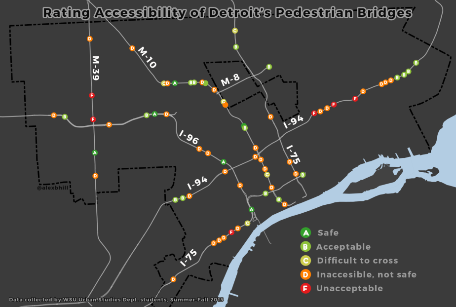
I had the pleasure of working with the 71X research team to visualize the data that they had collected on Detroit’s pedestrian (only) bridges. The student research team surveyed all 71 pedestrian bridges in Detroit.
From the 71X Team:
This is an independent study—an awareness-builder, too—introducing one side of a three-pronged problem in the City of Detroit. The intersection of accessibility, public health and safety. The team is comprised of Urban Studies’ students and community organizers working toward a more accessible Motor City. We study infrequent public transit and below standard “non-motorized” infrastructure with a commitment, again, to a prosperous Metro Area. From our vantage, Detroit is a big, three hundred and fifteen year old city severed into over a hundred neighborhoods. What is easily noticeable is its one-of-a-kind, sunken expressway network. It snakes through town, and detaches the city from itself. Interstates 75, 94, 96, and State Highways…
View original post 530 more words
