

Planning a city is a big job, but is it too much to ask for a coordinated effort?
The number of disparate boundaries in Detroit is both fascinating and befuddling: police scout car areas, curbside trash pickup zones, fire hydrant company areas, and on and on.
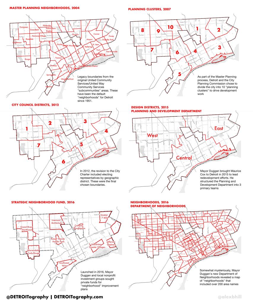
This post will focus on the various planning boundaries and what they mean for you. The boundaries will be discussed in chronological order, but all of these boundaries are actively used to plan the city’s future.
Master Plan Neighborhoods, 2004: These boundaries are the legacy of the United Community Services/United Way Community Services “subcommunities” first developed in 1951 and drawn along Census Tract boundaries so that Census data could be used to compare areas. These 54 areas have been the official “neighborhoods” since that time and remain so since the City’s Master Plan has not been updated since 2004.
Planning Clusters, 2007:…
View original post 211 more words
