

Inspired by Nathan Yau’s work at FlowingData on pizza place geography and grocery store geography, I wanted to see how Detroit’s ubiquitous locations compared. Driving along Van Dyke where there was church after church (many abandoned) interspersed with liquor stores gave me the idea of examining which type of location dominated Detroit’s landscape.
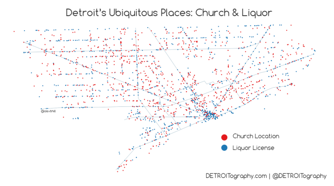 It takes forever to scrape the Michigan Liquor Control Commission (MLCC) website for active liquor licenses, so I relied on a 2012 dataset that I generated a while back. I then utilized data from Data Driven Detroit with Churches from 2011. The data is not perfect, but unless you have someone actively monitoring every liquor license and every church there is going to be significant change. Notably, the number of liquor licenses have been decreasing since 2009. The next step was to set up a grid that was generally half a square mile squares.
 There are…
View original post 157 more words
